Compiled by Philippa Stanford – research by Philippa Stanford, Leigh Chamberlain, Nick Feros, Genean Wildeisen, Lee Bull and numerous contributions on our facebook page.
This is a list of people who played prominent roles in the establishment of Toowong with a brief description. This is by no means complete and will continue to be updated. In some cases there are links to longer and more detailed articles.
Alexander Archer (1828-1890), manager of the Bank of New South Wales in Brisbane and a member of the Queensland pioneering Archer family. His wife was Mary Louisa, a daughter of Sir Robert Ramsay Mackenzie, 10th Baronet (1811-1873), a Queensland Premier (1867-68). The Archer residence, ‘Arley’, sat on the river bank at Toowong high above the flood zone of the Brisbane River. The Archer brothers were explorers and pastoralists and were among the earliest European settlers in Queensland. see here
 Joseph Stillman Badger (1851-1934) – an American who came to work for General Electric Company as its chief engineer to oversee the electrification of Brisbane’s outdated horse-drawn tram network for the Brisbane Tramways Company (BTC). Lived at Arlington/Endrim on Woodstock Rd, Toowong. See here
Elizabeth Bailey (1885-1965) was the first female real estate agent in Brisbane. After becoming widowed Mrs Bailey initially entered into a real estate partnership. The business was located in premises in an arcade situated in the front of the Jubilee Picture Theatre which fronted Jephson Street, Toowong. Later this site became the BP service station in Sherwood Road, Toowong. When her real estate partnership broke up, she decided to shift her business office out of the arcade and she transferred her business operations to her residence at 109 Sherwood Road, where she turned the front room into an office, and ran her business from here. She traded under her own name, ‘E. H. Bailey’, and she was the first local real estate agent in Toowong. See here
Dr Hugh Bell (d. 1897) was a noted physician and consultant at the Brisbane General Hospital. 1888 purchased Milton House at Milton. See here
Donald Bennett (1910-1986) was an aviator and founder of the RAF Pathfinders and author. Lived at Kingsford Dt, Auchenflower. See here
Mr E.J Bennett (1829-1920) was chief draughtsman in the Survey Office. Lived at a house at Bennett’s Bridge, Milton. See here
James Birrell (d. 2019) was one of Queensland’s preeminent architects who designed the Toowong Baths, the former Toowong Library, the J.D. Story Administration Building and the Union College Building at the University of Queensland amongst others. See here
Mrs FW Carr –Mr and Mrs Frederick Carr – purchased the Toowong Retreat Hotel property in 1868 and it became a residence. Mr Carr died May 1869 and Mrs Carr turned the hotel not a boarding house. Mrs FW Carr later became Mrs William Landsborough in 1873 and continued to live in the property Toowong Retreat Hotel until it was resumed by the railway lived in a house on the corner of the Indooroopilly or Long Pocket Road. Then the Landsboroughs moved to Curragh Bawn on the hill behind the Current Regatta Hotel
Dr. Henry Challinor (1814-1882) arrived on the SS Fortitude in 1849. He was a leader in medicine, civic affairs, and politician. He Lived at ‘Fairseat’ on Birdwood Terrace, the house Built by the late Augustus Charles Gregory for his brother Francis Gregory, around 1922. See here
Sir Alfred Cowley (1848-1926) and Lady Cowley (Charlotte nee Coppin) who was a cane farmer, industrialist and parliamentarian. They lived at Silky Oaks in Cross St, Toowong. See here
Robert Cribb is featured in TDHS’ logo
Mr. Robert Cribb (1805-1893) was born in England he emigrated to Brisbane 1849. In 1852 he purchased land in Auchenflower near current day Cribb St and called it Lang Farm in honour of John Dunmore Lang. He built Dunmore House on the corner of Coronation Drive and Lang Parade as his residence. He was a baker and land agent. He was a key figure in business and politics in Queensland. He was the leader of Brisbane’s ‘merchant group’ a founder of the Queensland Liberal Association. He was elected to the first Queensland Parliament and an alderman in the Brisbane City Council. See here
John Cribb (b. 1830) was the eldest son of Robert Cribb and one time accountant in the Bank of New South Wales. Lived at ‘Fairholme’, Milton . See here
Samuel Dart and his wife Eliza Anne Dart were the parents of Raymond Dart lived in Toowong in the late 19th Century. Samuel Dart was a member of Toowong Shore Council in 1896. See here
Raymond Dart (1893-1985) was a world-renowned anatomist and anthropologist, was born in Toowong in 1893. Discovered Australopithecus africanus in 1925 Johannesburg. See here
William Davies esq, a Welsh gold mining magnate. Dryswllyn later Raymond Lodge – 47 Cadell St, Auchenflower was constructed for him. He owned an extensive part of land between Milton Road, Dixon Street and Toowong Park. He later (1927) donated a portion of this estate to the Auchenflower Scouts and it is currently the HQ of the Scout Association of Australia. See here
Depper – Johan Michael and Elizabeth– after unsuccessfully searching for gold in Gympie they and their five children returned to Brisbane settling in Auchenflower c. 1879 behind what is now the Wesley Hospital. Mr Depper grew grapes in Germany and he continued this in Auchenflower.
Dr Graham Patrick Dixon CBE VD FRACS (1873-1947) was a surgeon doctor-soldier. Lived in the Dixon Family home, Clayton, with frontage on River Rd. See here
John Douglas (1828-1904) was a pastoralist and landowner who owned much of the land around Torwood (present day Auchenflower/Milton. Was Premier of Queensland 1877-1879 and Administrator and Government resident at Thursday Island (1885-1904). See here
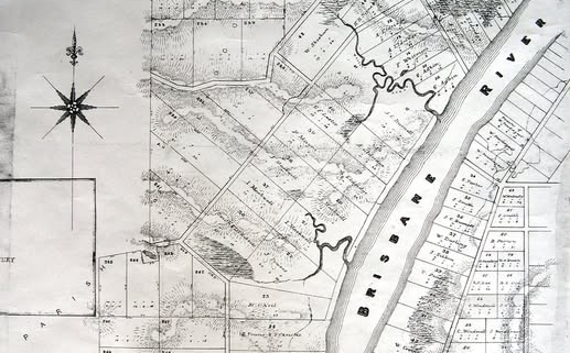
R.L. Drew (August 1862) in 1862 bought and subdivided land on the outskirts of Brisbane, setting up a signboard: ‘This is the village of Toowong’. Drew donated land for the first Church of St Thomas the Apostle, and was one of its original trustees. subdivided his land and called the collection of land subdivisions, Toowong. See here
Mrs RL Drew (Ann Drew c.1822 – 1907) was a welfare worker and wife, then widow, of the ‘father of Toowong’. She was secretary (1870-79) of the committee of the Lady Bowen Hospital and founder of the Infant Home and Women’s Refuge in 1871. The Drews’ friend J. B. Fewings described R. L. Drew as ‘timid, modest, and retiring’, yet unobtrusively successful in realizing his plans; by comparison, Ann Drew’s talents were much more evident and varied; he emphasized particularly her ‘great practicable ability’. Ann Drew died at Sandgate, near Brisbane, on 5 August 1907. The Drews are buried in Toowong cemetery.
George Edmonstone (1809-1883) a butcher and businessman who originally until mid 1850s owned Moorlands Estate. He was a member of the first Town Council of Brisbane (1859-1866) and its Mayor (1863-1864). His daughter married John Markwell which is how Markwell came to own the Moorlands Estate. See here
Ambrose Eldridge (c.1815-1860) was a retired Queen St chemist who died in 1860. In 1853 he had Milton House constructed for his residence. In retirement he grew cotton on Milton Farm in the vicinity of the house. Milton Cotton became the local fabric of the day. See here
Sir Arthur Fadden (1894-1973) – former Prime Minister of Australia. Lived at ‘Esk Mount’, Aston St, Toowong. See here
John Fenwick (1823-1900) came to Brisbane in 1864 setting up business as a hide and skin dealer and then a stock and station agent. He lived on Milton Rd near the Brewery. See here
Mr JB Fewings (d. 1910) and family lived at Carslake behind Mr Miskin’s house on Sherwood Road. JB Fewings was a schoolteacher who taught at the normal school and was headmaster at the Petrie Terrace School. See here
Eliza Fewings (1857-1940) established Somerville House and lived at Glen Olive, Toowong. See here
Richard Gailey (1834-1924) was a prominent architect who designed and built Glen Olive near Jack Cook Park. See here
Sir Augustus Charles Gregory (1819-1905) was a note explorer in Western Australia and Queensland and in 1859 he conducted an expedition in search of the lost explorer, Leichardt. He was the Surveyor-General in Queensland from 1859-1875. He was Mayor of Toowong for many years. See here
Francis (Frank) Thomas Gregory (1821-1888) – An explorer and politican. Brother of explorer Augustus Charles Gregory. Francis Gregory was appointed as a Commissioner of Crown Lands. He married Marion Hume in 1865, the sister of his surveying friend and protégé, Walter C. Hume.[1] From 1874, he was elected and served as a member of the Queensland Legislative Council. For a short period during 1883, he served as the appointed Postmaster-General of Queensland. His brother, Augustus Charles Gregory, built ‘Fairseat’ on Birdwood Terrace, for him in 1922. See here
Leititia Jephson (c.1827 – 1908) Born in Ireland around 1827 as Letita Arabin she emigrated to Australia in 1853 marrying Thomas Jephson a year later. after being widowed in her early forties became a successful businesswoman managing boarding houses in the city, Kangaroo Point and most notably the Longreach Private Boarding house. She purchased Cadbury on Kensington Terrace (on the current site of BBC boarding houses) around 1879 and renamed it Mallow after her birthplace in Ireland. She was a land agent and council member of the Women’s Franchise League which petitioned Parliament for votes for women. She travelled widely and was involved in a shipwreck in 1900.She sold the house to Sir Robert Philp in 1899. She died in January 1908 leaving a considerable estate. Church Street was renamed Jephson Street after her. See here
Mr. William Kellett (1839-1916) – a member of the State Legislative Assembly representing the Stanley electorate. Was a member of the firm Fenwick and Kellett, stock and station agents. Purchased an area of around 11 acres including Dryswllyn and the nearby Bowling green between Milton Road and what was Toowong Park now the Toowong Memorial Park. Kellett St is named after him.
William Land (1864-1933) was a master butcher and mayor of Toowong. He was born at Somerset, England and arrived in Brisbane as a youth. He first established his butchering business in High Street, Toowong, and during the next 40 years built up an extensive Wholesale and retail trade. He had a butcher’s shop on Sylvan Rd with paddocks extending from Sylvan Rd to Patrick Lane. He also added an ice manufacturing plant. Mr. Land took a prominent part in local authority affairs and was a councillor of the Toowong Town Council for many years, and mayor of the town on several occasions. He died in 1933 aged 68.
See here for a photo of the butcher shop
William Landsborough (1825-1866) was an explorer. He was born in Scotland and migrated to Australia in 1841. He explored and named Mount Nebo in 1856. In 1861 Landsborough was chosen by the Victorian and Queensland governments to lead a search for Robert O’Hara Burke and William Wills from the Gulf of Carpentaria southwards. After an arduous journey they learned that Burke and Wills had perished. He was fêted as the first explorer to cross the continent from north to south. After the death of his first wife from tuberculosis moved with his three daughters and made a home at Toowong. He was married to Maria Theresa Carr, née Carter, at Brisbane on 8 March 1873. They moved to Curragh Bawn on the hill behind the Current Regatta Hotel. See here
Reverend John Dunmore Lang (1799-1878) was an active worker in bringing immigrants to the Brisbane. He brought out immigrants on the Fortitude, Chaseley and Lima Ships. An early landowner in the are names his estate ‘Lang Farm in honour of Reverend Lang. See here
Vida Lahey (1882-1968) a well-known painter born in Brisbane who trained overseas. Vida Lahey also lived with her family in Toowong at Sidney House (later became a boarding house in the 1940s-mid- 50s) before moving to Indooroopilly. Sidney House was acquired by the ABC in the mid-1950s and demolished to make way for its studios to be built. See here
Ada Mary Laugher a talented amateur photographer who won prizes for her photographs and she worked as a clerk for the Brisbane Courier. Photographs taken by her have the initials AML. The Laugher sisters, Janie, Rosie and Ada Mary, of Benson St, Toowong, had initially moved to the district with their parents in 1890. Their father, Charles Henry Laugher, had operated pharmacies from the mid-1860s till around 1891, firstly in Rockhampton, then Ipswich, and later Beenleigh, and then in Taringa. She lived on Benson St. See here
Mr John Markwell was a resident at Moorlands, a wooden bungalow prior to the 1870s. In 1854 he acquired 52 acres of land later to be ‘Auchenflower’ (1880). This included land gifted from George Edmonstone when Markwell married his daughter and was 30 acres heading westwards and up to the higher ground of Milton Road. He was a businessman – involved in ironmongery, glassware and china retail. Mr John Markwell (jnr) in 1880 was appointed a foundation member of the new Toowong Shire Council. See here
Mayne family including Patrick Payne – butcher and grazier. Mrs Mary Mayne purchased and moved into Moorlands Villa in 1879 with her five children. The youngest was James O’Neill Mayne, the 17 yo. Upon her death in 1889 her second youngest child Mary Emelia Mayne (1858-1940) became custodian along with her brother, James. See here
Randall MacDonnell (1830-1877) was a school inspector. One time owner of Rathdonnell House which was named after him. See here
Thomas McIlraith (1835 – 1900) was three time Premier of Queensland. He and his wife Lady Harriette lived at Auchenflower House. Lady Harriette McIlwraith was the sister of Sir Arthur Palmer’s wife. Along with Sir Arthur Palmer he was involved in the scandal of the bankruptcy of the Queensland National Bank. See here
EJ Melville – Photographer Ernest, the photographer went on to run the State Govt. Insurance business in Toowoomba but died young at 45 years in 1935. His father, John was the sexton of Toowong Cemetery. Melville family were first residents on Musgrave St, Toowong. See here
Mr. WH Miskin was an amateur entomologist who had a fine collection of butterflies He lived next to Sherwood House on Sherwood Road. He was also the foundation chairman of the new Toowong Shire Council. He became the Governments Official Assignee and later the Colony’s first Official Trustee in Insolvency. See here
Sir Arthur Palmer (1819 – 1898) was born in Ireland and arrived in Sydney in 1838. He was a pastoralist and Premier of Queensland (1870-1874). Along with Thomas McIlwraith he was involved in the scandal of the bankruptcy of the Queensland National Bank. He died on 20 March 1898 at his home, Easton Gray, Toowong, Brisbane. See here
Lady Palmer was the wife of Sir Arthur Palmer and formerly Cecilia Jessie Mosman. She was also the sister of North Queensland identity Hugh Mosman for whom the town of Mossman is named. Note the extra S is a mistake
Charles Patterson (1843- 1926) was a Scottish immigrant who lived at Kinellar on Sherwood Rd. Emigrated to Brisbane in 1871. He originally worked as a gardener in the Botanic Gardens with Walter Taylor who later built the Walter Taylor Bridge at Indooroopilly. Charles Patterson started his sawmill business, Bon Accord at Indooroopilly in 1873. He was the founding member and president of the Toowong Horticultural Society. He was very active in local government, serving as a divisional councillor on both the Indooroopilly and Taringa Shire Councils, the Toowong Shire Council and later as Mayor of Toowong for three terms. As well as his political interests, Charles Patterson was chairman of the first Toowong State School committee and was always a great supporter of the school. He died on 4th January, 1926, aged 81. See here
Mr Henry Pears (1833-1903) purchased the site of current day Peerless Dry Cleaners on High St, Toowong in 1876. The property purchased from Heannah Ward and the present building was constructed on the site in the mid 1880s. In 1885-6 the building as occupied by Carver and Co who were drapers and fitters. He was a contractor and builder who was the contractor for St Thomas Church which was opened in 1877. The building was constructed for about £850. See here
The Petrie’s of Petrie’s Monumental Masons, Milton Road
Several generations of Petrie’s worked in Brisbane as stonemasons and builders. The first Andrew Petrie (1798 – 1872) was one of the Scottish mechanics brought to Sydney in 1831 by John Dunmore Lang as the nucleus of a new force of free workers. His work was so well regarded that in 1837 he was sent to Moreton Bay as the Superintendent of Works to oversee building works and he is known as The Father of Brisbane. In 1840 he started the family business which passed to his son, John (1822-1892), who was a builder, architect and stonemason in 1848. He was elected first Mayor of Brisbane. In 1882 his eldest son, Andrew Lang Petrie (1854-1928), took over his father’s reconstructed firm, John Petrie & Son. By then the business focused on cabinet making and joinery, brick and tile making and monumental masonry.
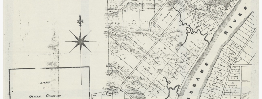
He was also a trained architect, builder and stonemason and served in the Queensland Parliament as a Member of the Legislative Assembly for 33 years. The firm went bankrupt in the depression of 1894 but was later revived as monumental masons only. The Monumental Works was located opposite the main Toowong Cemetery gates. Andrew was a member of the Brisbane General Cemetery Board.
In the 1920s the business passed to John George Petrie, an architect and sportman, then to John Robert Petrie then to John Ronald Petrie who took over the business in the 1970s. He was a well regarded architect, stonemason and builder, and was responsible for the restoration of many of Queensland’s most iconic buildings – many of which the Petrie’s had originally built. The Petrie business continues to offer design and building services.
For more information see here and here
Sir Robert Philp (1851-1922) was a businessman and two time premier of Queensland. He was born in Scotland arrived in Australia in 1862. He lived at ‘Mallow’/’Cadbury’ on Kensington Terrace, Toowong. See here
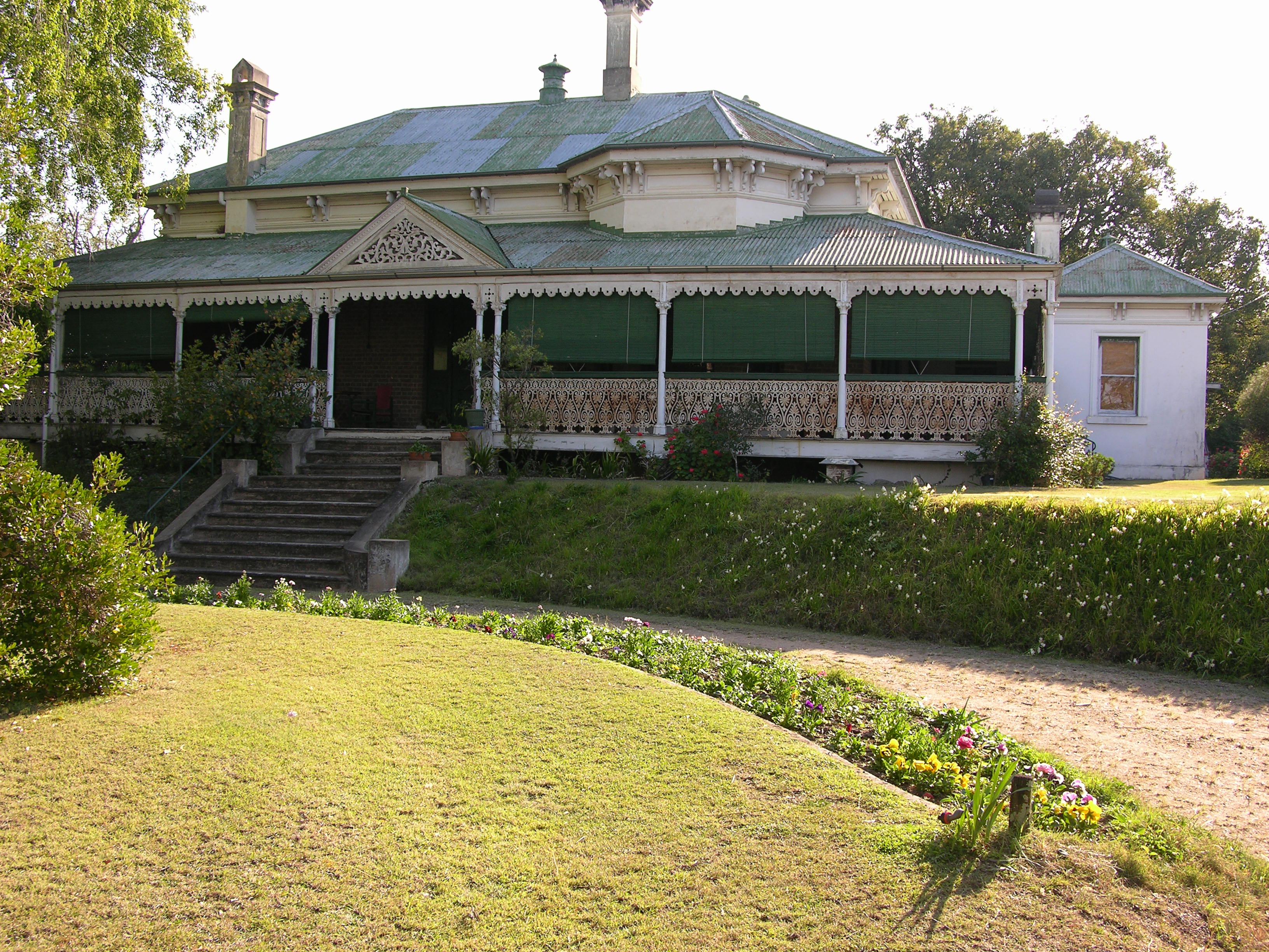
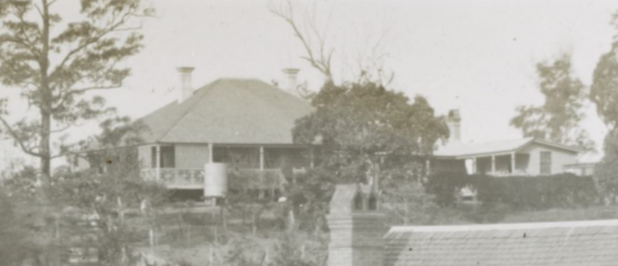
Mrs Rogers d. 1875 – in 1865 purchased 2.4 hectares of land at Toowong on an elevated spot on the river, later the site of the ABC in Toowong. James Cowlishaw constructed a house for her in 1865 on this site called Middenbury which still stands today. The house is an example of mid 19th Century architecture. Upon her death she left the house and land to her four children and it eventually was purchased by the O’Shea family in 1891 who lived in the house for 59 years making a number of renovations in this time. 1860s home on ABC Toowong site heritage listed (brisbanetimes.com.au)
Thomas Joseph Ryan (1876-1921) was one of the first Australian born politicians to be State Premier. He married Lily Virginia Cook and was a barrister and member of the Labor party. He lived at Auchenflower house from around 1910 until his death. See here
David Thompson Seymour, Queensland’s first Commissioner of Police, in 1864-1895. One time owner of Milton House, Milton around 1887. See here
Charles Siemon (1871-19410) Mayor of Town of Toowong and his family. The Siemon family were pioneers of present day Auchenflower and Milton. Councillor Siemon member of Toowong Shire Council 1896. The family – William Siemon, a grain merchant bought Milton House in 1904. Ernest Siemon built ‘Ravensfield’ on River Road in 1911. Later known as the Siemon Dairy Farm or Siemon’s Jersey Dairy (C. 1932-1940). See here
Francis Drummond FDG Stanley (1839 – 1897) was a government architect born in Scotland and migrated to Queensland in the early 1860s. He designed the former State Library at 159 William Street, the old government morgue on Queen’s Wharf Road as well as numerous other buildings. He was appointed colonial architect in 1871 and remained in this role until 1881 when he went into private practise. He owned a large property off Stanley Terrace and built his home there. He sold the property to Sir Arthur Palmer who named it Easton Grey and relocated to a house he built in Jephson St called Ardencraig – Church St now Jephson St, Toowong
Mr John Warde the property known as Auchenflower was purchased by Mr John Warde who built the original Auchenflower House. He went to Sydney and started a periodical called the Pacific Monthly
Henry Charles Stanley (1840–1921) was the chief engineer of the railways in Queensland, Australia. On arrival in Queensland in 1863 , Stanley was employed by the railway department of the Queensland Government and in 1891, he was formally appointed the Chief Engineer for the entire Queensland network. In this role he designed the second Albert Bridge from Indooroopilly to Chelmer and this is considered his major work. Henry Charles Stanley purchased Ascog in Ascog Terrace and later moved to Tighnabruaich, designed by his brother, in Indooroopilly in the early 1890s. See here
William (1834-1919) and Margaret Winterford (b. 1844-?) William purchased the original Regatta Hotel in 1882 on the Brisbane River at Sylvan Road in Toowong. He commissioned architect Richard Gailey to design a much larger building which was opened in 1887. See here


 Joseph Stillman Badger (1851-1934) – an American who came to work for General Electric Company as its chief engineer to oversee the electrification of Brisbane’s outdated horse-drawn tram network for the Brisbane Tramways Company (BTC). Lived at Arlington/Endrim on Woodstock Rd, Toowong. See
  James Birrell (d. 2019) was one of Queensland’s preeminent architects who designed the Toowong Baths, the former Toowong Library, the J.D. Story Administration Building and the Union College Building at the University of Queensland amongst others. See
 Raymond Dart (1893-1985) was a world-renowned anatomist and anthropologist, was born in Toowong in 1893. Discovered Australopithecus africanus in 1925 Johannesburg. See
  Depper – Johan Michael and Elizabeth– after unsuccessfully searching for gold in Gympie they and their five children returned to Brisbane settling in Auchenflower c. 1879 behind what is now the Wesley Hospital. Mr Depper grew grapes in Germany and he continued this in Auchenflower.
 Sir Arthur Fadden (1894-1973) – former Prime Minister of Australia. Lived at ‘Esk Mount’, Aston St, Toowong. See
  Eliza Fewings (1857-1940) established Somerville House and lived at Glen Olive, Toowong. See
 Sir Augustus Charles Gregory (1819-1905) was a note explorer in Western Australia and Queensland and in 1859 he conducted an expedition in search of the lost explorer, Leichardt. He was the Surveyor-General in Queensland from 1859-1875. He was Mayor of Toowong for many years. See
  William Landsborough (1825-1866) was an explorer. He was born in Scotland and migrated to Australia in 1841. He explored and named Mount Nebo in 1856. In 1861 Landsborough was chosen by the Victorian and Queensland governments to lead a search for
  Reverend John Dunmore Lang (1799-1878) was an active worker in bringing immigrants to the Brisbane. He brought out immigrants on the Fortitude, Chaseley and Lima Ships. An early landowner in the are names his estate ‘Lang Farm in honour of Reverend Lang. See
  Vida Lahey (1882-1968) a well-known painter born in Brisbane who trained overseas. Vida Lahey also lived with her family in Toowong at Sidney House (later became a boarding house in the 1940s-mid- 50s) before moving to Indooroopilly. Sidney House was acquired by the ABC in the mid-1950s and demolished to make way for its studios to be built. See
  Thomas McIlraith (1835 – 1900) was three time Premier of Queensland. He and his wife Lady Harriette lived at Auchenflower House. Lady Harriette McIlwraith was the sister of Sir Arthur Palmer’s wife. Along with Sir Arthur Palmer he was involved in the scandal of the bankruptcy of the Queensland National Bank. See
  Sir Arthur Palmer (1819 – 1898) was born in Ireland and arrived in Sydney in 1838. He was a pastoralist and Premier of Queensland (1870-1874). Along with Thomas McIlwraith he was involved in the scandal of the bankruptcy of the Queensland National Bank. He died on 20 March 1898 at his home, Easton Gray, Toowong, Brisbane. See
  Charles Patterson (1843- 1926) was a Scottish immigrant who lived at Kinellar on Sherwood Rd. Emigrated to Brisbane in 1871. He originally worked as a gardener in the Botanic Gardens with Walter Taylor who later built the Walter Taylor Bridge at Indooroopilly. Charles Patterson started his sawmill business, Bon Accord at Indooroopilly in 1873. He was the founding member and president of the Toowong Horticultural Society. He was very active in local government, serving as a divisional councillor on both the Indooroopilly and Taringa Shire Councils, the Toowong Shire Council and later as Mayor of Toowong for three terms. As well as his political interests, Charles Patterson was chairman of the first Toowong State School committee and was always a great supporter of the school. He died on 4th January, 1926, aged 81. See
  Sir Robert Philp (1851-1922) was a businessman and two time premier of Queensland. He was born in Scotland arrived in Australia in 1862. He lived at ‘Mallow’/’Cadbury’ on Kensington Terrace, Toowong. See
 Francis Drummond FDG Stanley (1839 – 1897) was a government architect born in Scotland and migrated to Queensland in the early 1860s. He designed the former State Library at 159 William Street, the old government morgue on Queen’s Wharf Road as well as numerous other buildings. He was appointed colonial architect in 1871 and remained in this role until 1881 when he went into private practise. He owned a large property off Stanley Terrace and built his home there. He sold the property to Sir Arthur Palmer who named it Easton Grey and relocated to a house he built in Jephson St called Ardencraig – Church St now Jephson St, Toowong
 William (1834-1919) and Margaret Winterford (b. 1844-?) William purchased the original Regatta Hotel in 1882 on the Brisbane River at Sylvan Road in Toowong. He commissioned architect Richard Gailey to design a much larger building which was opened in 1887. See